Просмотр новости
Найдите то, что Вас интересует
 Спутники
 РН
РН SpaceX
 Роскосмос
 NASA
NASA
СпутникиРНSpaceXРоскосмосNASA
This month, San Francisco welcomed what may be the most icon-filled walking and biking trail in the entire American national park system.The Golden Gate Dozen, which stretches 13 waterfront miles from Crissy Field to Fort Funston, connects some of the city’s most remarkable landscapes and vistas with stops at historical sites and money shots of the Golden Gate Bridge from every angle.A partnership between the Golden Gate National Parks Conservancy, the Public Lands Program, and hiking app AllTrails helped to define the route, which is broken down into bite-sized sections between 12 major stops (hence its name, the Golden Gate Dozen). A cheerful mascot, a pink-frosted donut (it’s the Golden Gate Dozen, remember?), marks the route at a few of the stops IRL (collect all four stickers!). The doughy guide to the Golden Gate Dozen Trail(Courtesy of Golden Gate National Parks Conservancy)In general, though, there is not yet any new, official signage; the AllTrails map will keep you on track. "The Golden Gate Dozen is the kind of trail that shows why urban access to public lands matters,” says Pitt Grewe, head of social and environmental impact at AllTrails. “A route that connects San Francisco’s rich history and unique ecology to its diverse community is a powerful reminder of what we're working to protect and make accessible for everyone." Below, we’ve broken down each section of the trail. Tackle the full 13 miles in a single day, conquer it piece by piece, or pick out just the spots you most want to see.Crissy Field to Presidio Tunnel Tops: 0.5 milesFrom the East Beach Parking Lot at Crissy Field, you’ll walk west along the promenade, then cut through the East Bluff Picnic Area to the bridge over the marsh. Watch for great blue herons and belted kingfishers, then head west down Mason Street to the Presidio Tunnel Tops.Presidio Tunnel Tops to Fort Point: 1.5 milesTake in the views (and maybe brunch at Dalida in the Presidio’s adjacent Main Post; 101 Montgomery Street, Suite 100), then cross back over Mason Street to Crissy Field. Stop at the Warming Hut on the promenade for a Crissy Mocha and a donut sticker before continuing on to Fort Point National Historic Site. Crissy Field(Courtesy of @415urbanadventures)Fort Point to the Golden Gate Bridge: 0.7 milesCheck out the fort’s exhibits on the history of the “guardian of the Golden Gate,” then return back toward the Warming Hut, popping into the Presidio Visitor Center for another sticker along the way. Look for the sign pointing to Battery East and the Golden Gate Bridge. Head up the steps, then follow the trail to the Golden Gate Bridge Welcome Plaza.Golden Gate Bridge to Baker Beach: 1.5 to around 3 milesReturn to the Battery East Trail, take a left under the bridge, and continue up the California Coastal Trail. Snap a photo of the bridge from the overlook, then either continue on this easier, shorter trail (about 20 minutes) or the longer and more challenging Batteries to Bluffs Trail (about an hour). Take the Sand Ladder down to the beach to beachcomb the next section, or stay on the more solid Coastal Trail as it passes alongside Baker Beach.Baker Beach to the Presidio: 0.1 miles to around 0.9 milesExplore Battery Chamberlin, then continue past two parking lots and around the fence through the sand. Take the staircase at the end of Baker Beach up to the tony Sea Cliff neighborhood. If you want a little more time in the Presidio, zag over to the Lobos Creek Valley Trail before you do, taking Gibson Road toward Bowley Street and crossing over Lincoln to the trailhead at the native dunes; the trail adds a little less than a mile to your route. When you’re done, head back out to Lincoln Street and toward Sea Cliff Avenue.The Presidio to China Beach: 0.7 milesFollow Sea Cliff Avenue down to China Beach, a hidden cove where Gold Rush-era Chinese immigrants camped and fished. Return the way you came until you reach 29th Avenue and El Camino del Mar. The stairs to the Sutro Baths(Courtesy of Golden Gate National Parks Conservancy)China Beach to Lands End: 1.2 milesTake El Camino Del Mar into Lincoln Park and turn right to pick up the California Coastal Trail again. Follow the path through Lands End, the same route down which a train once carried San Franciscans to the Sutro Baths, and don’t miss the views at Eagle’s Point and the Lands End Lookout, where sticker number three awaits.Lands End to Sutro Baths: 0.6 milesNerd out on the history of the Sutro Baths at the Lookout before crossing busy Point Lobos Avenue to the Sutro Heights parking lot.Sutro Baths to Sutro Heights: 0.3 milesCheck out the remains of Adolph Sutro’s legacy, including what was once the world’s largest indoor swimming pool, then follow the main trail to the southern end of Sutro Heights Park. Continue downhill to Balboa Street.Sutro Heights to Ocean Beach: 3 milesCarefully cross the Great Highway to Ocean Beach. Walk along the beach, take the Esplanade Trail, or pass through Sunset Dunes. If this is your ending point, consider bringing a picnic or lighting a bonfire on the beach. Otherwise, continue all the way to the end of the Great Highway and take a left on Sloat Boulevard. Fort Funston(Courtesy of Golden Gate National Parks Conservancy)Ocean Beach to Fort Funston: 5.7 milesThis last section is the longest by far, but since it’s mostly on pavement, at least it’s easy going. Follow Sloat past the SF Zoo and take a right on Skyline Boulevard. Cross Skyline, then continue south along the road to John Muir Drive and Fort Funston, where there is another battery to explore (Battery Davis), hang gliders to see, and dogs to watch running through the surf.// Learn more at parksconservancy.org and find the route at AllTrails
The Golden Gate Dozen, which stretches 13 waterfront miles from Crissy Field to Fort Funston, connects some of the city’s most remarkable landscapes and vistas with stops at historical sites and money shots of the Golden Gate Bridge from every angle.
A partnership between the Golden Gate National Parks Conservancy, the Public Lands Program, and hiking app AllTrails helped to define the route, which is broken down into bite-sized sections between 12 major stops (hence its name, the Golden Gate Dozen). A cheerful mascot, a pink-frosted donut (it’s the Golden Gate Dozen, remember?), marks the route at a few of the stops IRL (collect all four stickers!).
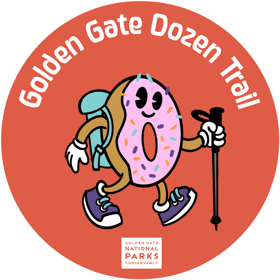 The doughy guide to the Golden Gate Dozen Trail(Courtesy of Golden Gate National Parks Conservancy)
In general, though, there is not yet any new, official signage; the AllTrails map will keep you on track.
"The Golden Gate Dozen is the kind of trail that shows why urban access to public lands matters,” says Pitt Grewe, head of social and environmental impact at AllTrails. “A route that connects San Francisco’s rich history and unique ecology to its diverse community is a powerful reminder of what we're working to protect and make accessible for everyone."
Below, we’ve broken down each section of the trail. Tackle the full 13 miles in a single day, conquer it piece by piece, or pick out just the spots you most want to see.
Crissy Field to Presidio Tunnel Tops: 0.5 milesFrom the East Beach Parking Lot at Crissy Field, you’ll walk west along the promenade, then cut through the East Bluff Picnic Area to the bridge over the marsh. Watch for great blue herons and belted kingfishers, then head west down Mason Street to the Presidio Tunnel Tops.
Presidio Tunnel Tops to Fort Point: 1.5 milesTake in the views (and maybe brunch at Dalida in the Presidio’s adjacent Main Post; 101 Montgomery Street, Suite 100), then cross back over Mason Street to Crissy Field. Stop at the Warming Hut on the promenade for a Crissy Mocha and a donut sticker before continuing on to Fort Point National Historic Site.
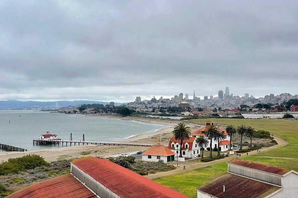 Crissy Field(Courtesy of @415urbanadventures)
Check out the fort’s exhibits on the history of the “guardian of the Golden Gate,” then return back toward the Warming Hut, popping into the Presidio Visitor Center for another sticker along the way. Look for the sign pointing to Battery East and the Golden Gate Bridge. Head up the steps, then follow the trail to the Golden Gate Bridge Welcome Plaza.
Golden Gate Bridge to Baker Beach: 1.5 to around 3 milesReturn to the Battery East Trail, take a left under the bridge, and continue up the California Coastal Trail. Snap a photo of the bridge from the overlook, then either continue on this easier, shorter trail (about 20 minutes) or the longer and more challenging Batteries to Bluffs Trail (about an hour). Take the Sand Ladder down to the beach to beachcomb the next section, or stay on the more solid Coastal Trail as it passes alongside Baker Beach.
Baker Beach to the Presidio: 0.1 miles to around 0.9 milesExplore Battery Chamberlin, then continue past two parking lots and around the fence through the sand. Take the staircase at the end of Baker Beach up to the tony Sea Cliff neighborhood. If you want a little more time in the Presidio, zag over to the Lobos Creek Valley Trail before you do, taking Gibson Road toward Bowley Street and crossing over Lincoln to the trailhead at the native dunes; the trail adds a little less than a mile to your route. When you’re done, head back out to Lincoln Street and toward Sea Cliff Avenue.
The Presidio to China Beach: 0.7 milesFollow Sea Cliff Avenue down to China Beach, a hidden cove where Gold Rush-era Chinese immigrants camped and fished. Return the way you came until you reach 29th Avenue and El Camino del Mar.
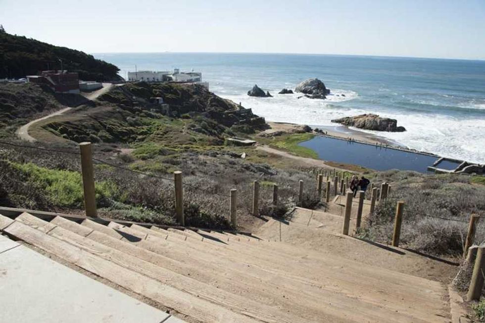 The stairs to the Sutro Baths(Courtesy of Golden Gate National Parks Conservancy)
Take El Camino Del Mar into Lincoln Park and turn right to pick up the California Coastal Trail again. Follow the path through Lands End, the same route down which a train once carried San Franciscans to the Sutro Baths, and don’t miss the views at Eagle’s Point and the Lands End Lookout, where sticker number three awaits.
Lands End to Sutro Baths: 0.6 milesNerd out on the history of the Sutro Baths at the Lookout before crossing busy Point Lobos Avenue to the Sutro Heights parking lot.
Sutro Baths to Sutro Heights: 0.3 milesCheck out the remains of Adolph Sutro’s legacy, including what was once the world’s largest indoor swimming pool, then follow the main trail to the southern end of Sutro Heights Park. Continue downhill to Balboa Street.
Sutro Heights to Ocean Beach: 3 milesCarefully cross the Great Highway to Ocean Beach. Walk along the beach, take the Esplanade Trail, or pass through Sunset Dunes. If this is your ending point, consider bringing a picnic or lighting a bonfire on the beach. Otherwise, continue all the way to the end of the Great Highway and take a left on Sloat Boulevard.
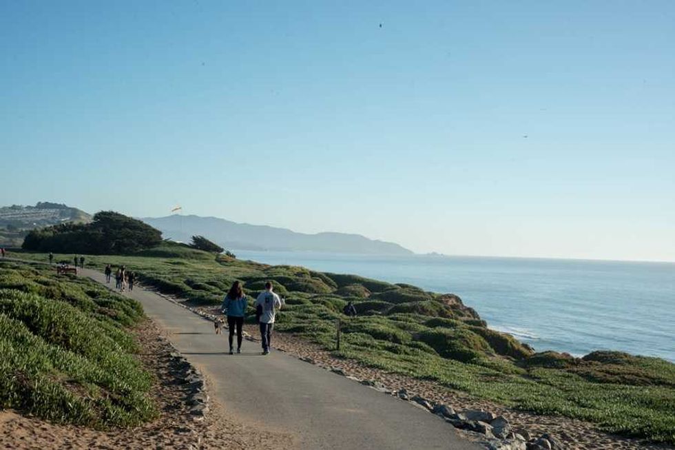 Fort Funston(Courtesy of Golden Gate National Parks Conservancy)
This last section is the longest by far, but since it’s mostly on pavement, at least it’s easy going. Follow Sloat past the SF Zoo and take a right on Skyline Boulevard. Cross Skyline, then continue south along the road to John Muir Drive and Fort Funston, where there is another battery to explore (Battery Davis), hang gliders to see, and dogs to watch running through the surf.
// Learn more at parksconservancy.org and find the route at AllTrails
| # | Наименование новости | Тональность | Информативность | Дата публикации |
|---|---|---|---|---|
| 1 | 7 Essential Bay Area Experiences to Fill Out Your Summer Bingo Card | 0 | 12.86 | 04-08-2026 |
| 2 | 5 Hikes Showcasing Sonoma County from the Coast to the Redwoods | 0 | 12.8 | 23-07-2026 |
| 3 | 27 Fun Things to Do This Week (8.3.26) | 0 | 8.78 | 31-07-2026 |
| 4 | What to Eat at Outside Lands 2026: Limited Editions, a New Snack Series + More | 0 | 8.48 | 03-08-2026 |
| 5 | 29 Fun Things to Do This Week (7.20.26) | 0 | 10.87 | 17-07-2026 |
| 6 | Bare it All at These Nude Beaches, Hot Springs + Clothing-Optional Escapes in the Bay and Beyond | 0 | 7.85 | 22-07-2026 |
| 7 | 29 Fun Things to Do This Week (7.27.26) | 0 | 12.09 | 24-07-2026 |
| 8 | 11 Summer Essentials for Dolores Park, a Weekend Getaway, or a European Escape | 0 | 13.53 | 20-07-2026 |
| 9 | Lace up, roll out, and boogie down at Roller Disco Daze at the Marin County Fairgrounds. | 0 | 6.86 | 14-07-2026 |
| 10 | Loved 'Voicemails for Isabelle'? Watch These 9 Romance Movies Set in San Francisco Next | 6 | 5 | 30-06-2026 |